


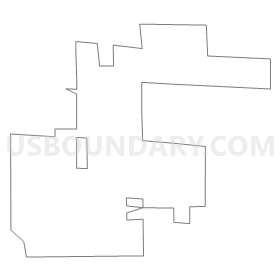
Precinct 3485, Clark County, Nevada
About
Outline
Summary
| Unique Area Identifier | 614159 |
| Name | Precinct 3485 |
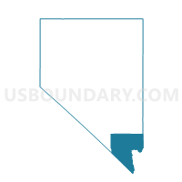
| County | Clark County |
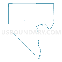
| State | Nevada |
| Area (square miles) | 0.46 |
| Land Area (square miles) | 0.46 |
| Water Area (square miles) | 0.00 |
| % of Land Area | 100.00 |
| % of Water Area | 0.00 |
| Latitude of the Internal Point | 36.26916010 |
| Longtitude of the Internal Point | -115.24412190 |
Maps

Graphs
Select a template below for downloading or customizing gragh for Precinct 3485, Clark County, Nevada


Neighbors
Neighoring Voting District (by Name) Neighboring Voting District on the Map
- Precinct 3455, Clark County, NV
- Precinct 3456, Clark County, NV
- Precinct 3469, Clark County, NV
- Precinct 3470, Clark County, NV
- Precinct 3477, Clark County, NV
- Precinct 3484, Clark County, NV
- Precinct 3488, Clark County, NV
- Precinct 3490, Clark County, NV
- Precinct 3492, Clark County, NV
- Precinct 3493, Clark County, NV
Top 10 Neighboring County Subdivision (by Population) Neighboring County Subdivision on the Map
Top 10 Neighboring Place (by Population) Neighboring Place on the Map
Top 10 Neighboring Unified School District (by Population) Neighboring Unified School District on the Map
Top 10 Neighboring State Legislative District Lower Chamber (by Population) Neighboring State Legislative District Lower Chamber on the Map
Top 10 Neighboring State Legislative District Upper Chamber (by Population) Neighboring State Legislative District Upper Chamber on the Map
Top 10 Neighboring 111th Congressional District (by Population) Neighboring 111th Congressional District on the Map
Top 10 Neighboring Census Tract (by Population) Neighboring Census Tract on the Map
- Census Tract 33.05, Clark County, NV (5,377)
- Census Tract 33.03, Clark County, NV (4,769)
- Census Tract 33.10, Clark County, NV (4,724)
- Census Tract 33.20, Clark County, NV (4,263)
- Census Tract 33.08, Clark County, NV (2,911)